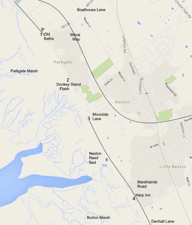
Go through Neston taking the road to Ness and Burton. Just over half a mile after the shops at Neston turn right at a mini roundabout down Marshlands Road. At the shore turn left past the Harp Inn to Denhall Quay (4). This an excellent view point over the marsh and nearby Denhall Gutter. Paths go from here along the shore both to Neston one way and Denhall (near Burton) the other. The footpath going towards Neston (towards Moorside Lane) takes you to the Neston Old Quay (5) with Neston Reed Bed on the edge of the marsh to your left and Neston Sewage Farm inland to your right. You can still see the sandstone quay last used in the 19th century. You can park at both the end of Marshlands Road and at Denhall Quay but beware that the end of Marshlands Raod gets floded on a high spring tide.
Neston has railway links with Birkenhead and Wrexham. There is a good bus service to Birkenhead and Chester. Grid Refs: Parkgate Old Baths SJ275788.