Map of Flint and Bagillt
Directions
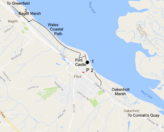
On the right (seaward) side of the dual carriageway approaching Flint is the RSPB reserve at Oakenholt. This is not open to the public but there is a hide overlooking the reserve from the south at the Connah's Quay Nature Reserve, and you can view the reserve from the north at Flint. The signpost to Flint Castle (1) from the A548 in the middle of Flint is easy to miss. It takes you over a humpback bridge along Castle Road. Turn left to the Castle or right to the lifeboat station (2), both have good car parks. There are good views across the estuary at both places. A path going south-east from the lifeboat station gives views over Oakenholt Marsh. The Wales Coastal Path heads north-west from Flint Castle eventually reaching Bagillt Marsh (3) and then onwards towards Greenfield and beyond. If driving continue on the A548 out of Flint towards Greenfield, you can access the coastal path at Bagillt where there is a footbridge over the railway.
Flint has a station on the Chester to Holyhead Railway line. Map Refs. Flint Castle SJ247735, Bagillt SJ224750.