|
Back to Welsh Shore Map of Point of Ayr and Talacre 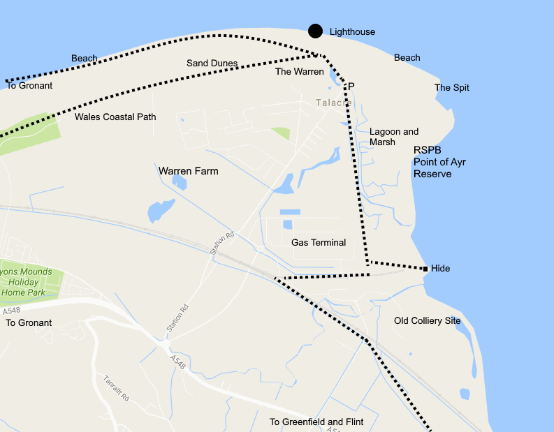 |
|
|
Directions: From
Ffynnongroyw continue north on the A548 until a roundabout is reached.
Turn right towards Talacre. At the end of the road is a car park on the
right. The Point of Ayr RSPB
reserve and hide are to the right and Talacre marsh and Point of Ayr
Lighthouse to the left. The shore by the lighthouse is a good beach
backed by sand dunes. This is a good spot for sea-watching, continue
walking to get to Gronant.Those wanting to visit the hide
overlooking Talacre fields (Warren Farm) where there can be large numbers of
waders present at high tide can get the keys at any time
from the visitor centre at BHPBilliton during office hours and at the BHPBilliton security office all
other times. The hide is on Station Road (on the way to the Point of Ayr) just
next to the railway bridge.
The nearest railway stations are at Flint and Prestatyn with a bus service between. Map Ref. Point of Ayr Lighthouse SJ122854. | |